 GTA6STAR
லியோனிடா வரைபடம்
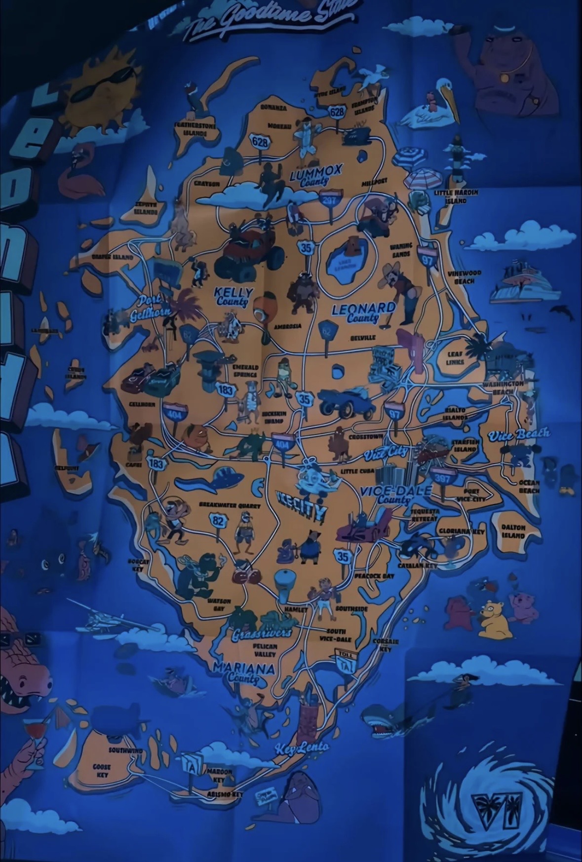
Explore Leonida with the illustrated map and region checklist.
பிராந்திய சரிபார்ப்பு பட்டியல்
0 / 6 பகுதிகள் சரிபார்க்கப்பட்டன
இந்தப் பெயர்கள் ராக்ஸ்டாரின் பிராந்திய-லேபிளிடப்பட்ட மீடியாவில் தோன்றும். படங்கள் சரியான எல்லைகள் அல்லது ஆயங்களை நிறுவவில்லை.
Checklist progress stays in this browser. Exact pins still need verified coordinate sources.
இந்த புல குறியீட்டை எவ்வாறு பயன்படுத்துவது
- Zoom into the map or open the full-size image. Search for region names in the checklist.
- தங்கள் சொந்த சரிபார்க்கப்பட்ட தரவுத்தொகுப்பில் உள்ளீடுகள் இருக்கும்போது பின் வடிகட்டிகள் கிடைக்கும்.
- இந்த உலாவியில் நீங்கள் ஆராய்ந்த இடங்களைக் கண்காணிக்கவும்.
This illustrated map was supplied by the site owner. Its labels and geography are a visual reference; verified in-game coordinates are not available.